The map below is interactive - click on it
The map below was created by Caitlan Stroonsnyder as part of our Lake Management Plan. It shows the watersheds that directly impact our lake.
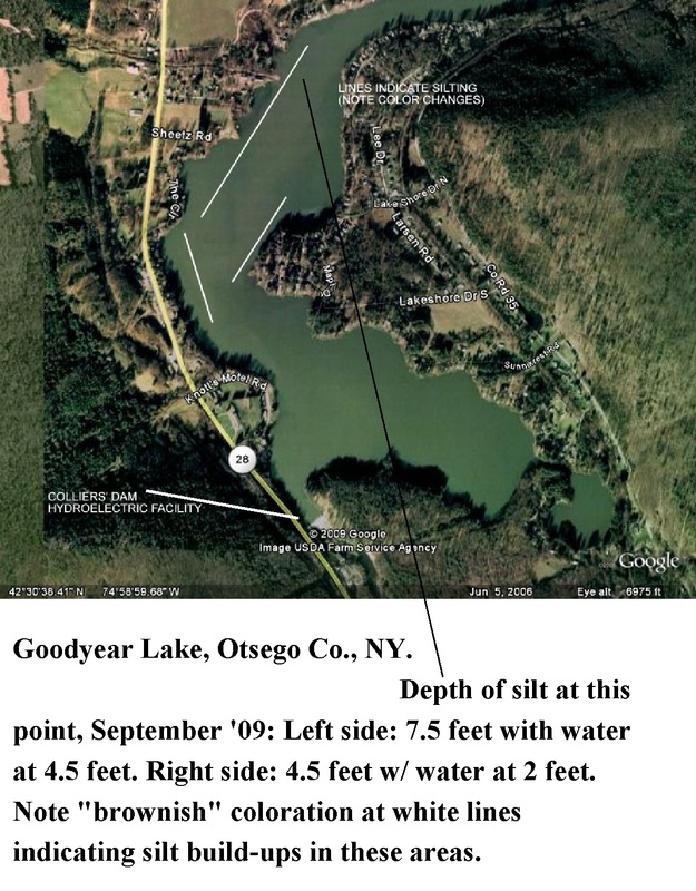
The map below indicates the silting in the upper regions of our lake.